UK
UK  EN
EN 
S.T.A.N. — a situational awareness and incident management platform
PSIM Solutions forsmart citiescontrol roomslarge-scale sites
S.T.A.N. is an intelligent platform that brings together video surveillance, IoT sensors, traffic data, analytics and operational response within a single information environment. It creates a centralised data lake and provides continuous situational awareness across cities, critical infrastructure sites and high-risk areas.
SYSTEM CHALLENGES
Challenges addressed by S.T.A.N.
Modern cities, business centres and critical infrastructure facilities rely on dozens of separate systems, including video surveillance, IoT sensors, SCADA, BMS, traffic management systems and control room platforms.
However, these systems operate in isolation, without a unified command and control environment. As a result:
Events are recorded, but they are not correlated.
Response is delayed.
Data is dispersed across separate systems.
There is no complete view of the situation.
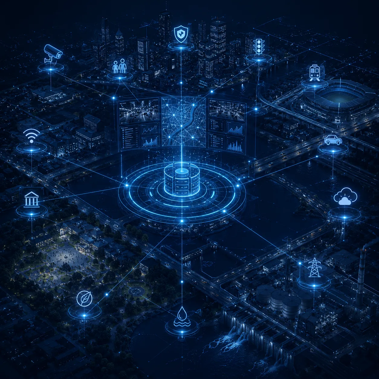
S.T.A.N. creates a unified control room environment where events, incidents, cameras, sensors and response teams are brought together within a single PSIM platform.
UNIFIED PLATFORM
What is the S.T.A.N. PSIM platform?
S.T.A.N. (SITUATIONAL AWARENESS. TRAFFIC CONTROL. ANALYTICS. NORMALISATION.) is a PSIM (Physical Security Information Management) software platform designed to centralise the aggregation, analysis and management of events and incidents across cities and large-scale sites.
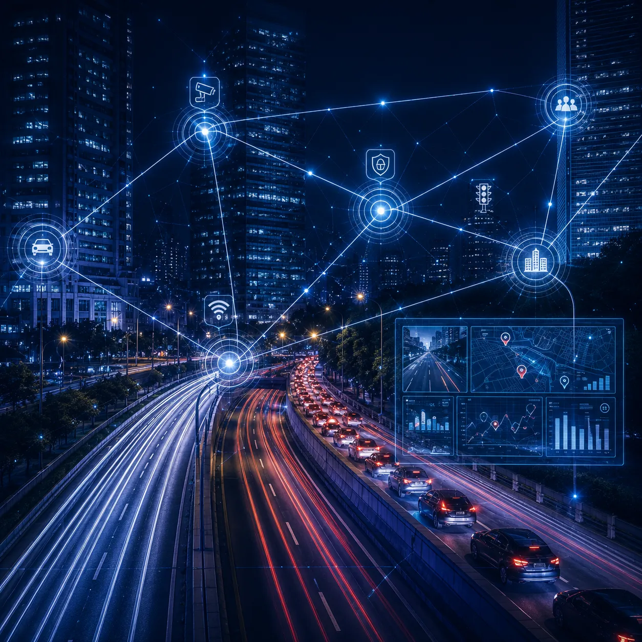
THE SYSTEM INTEGRATES
Video surveillance and video analytics
IoT, BMS and SCADA systems
Transport and environmental sensors
Information systems used by emergency and response services
and brings them together within a unified, analytics-driven and centrally managed environment.
PLATFORM WORKFLOW
How S.T.A.N. works
System workflow
01
Events
S.T.A.N. automatically collects data from video cameras, IoT sensors, SCADA, BMS, transport and environmental systems.
02
Correlation rules
Events are analysed and correlated using predefined rules to determine the incident type, severity and response priority.
03
Incidents
Operators receive a complete view of the incident within a single interface, including the incident location, video feeds, sensor data, root cause and responsible personnel.
04
Response
The system automatically triggers Standard Operating Procedures (SOPs) and delivers information to responsible personnel via the web interface and mobile devices.
05
Reporting
All events and user actions are recorded and presented in interactive real-time reports.
CONTROL AND COORDINATION
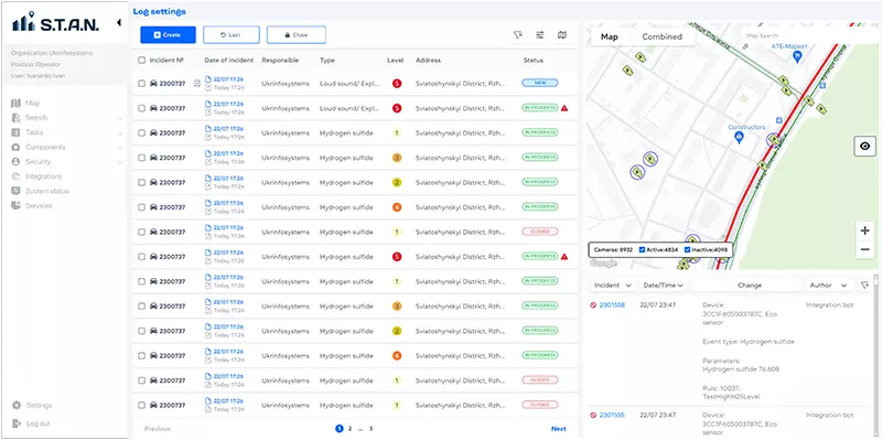
Centralised incident management
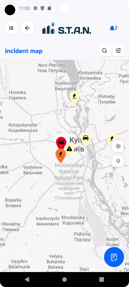
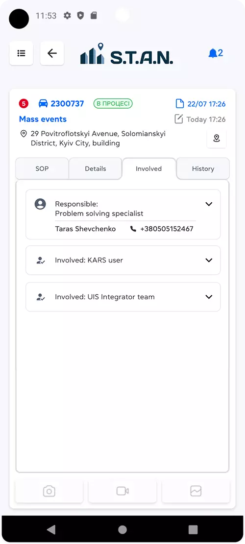
S.T.A.N. provides end-to-end control over events and incidents, with detailed information available for every case.
The platform enables teams to:
- assess severity and set priorities;
- automatically assign responsible personnel;
- record every action in the audit log;
- display incidents on an interactive map;
- coordinate response teams in real time.
This creates a transparent, controlled and rapid incident response environment for cities and large-scale sites.
SPATIAL AWARENESS
Geolocation, cameras and video analytics
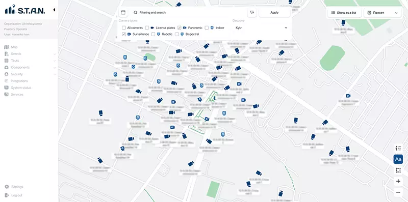
S.T.A.N. enables users to manage and monitor incidents and events through an interactive map. They can access cameras, view their status and retrieve archived footage, while also analysing relationships between locations, assets and events.
Route planning and camera linkage tools significantly improve operational response to incidents. Real-time video analytics enables rapid detection and identification of people and vehicles.
SITUATIONAL AWARENESS
Real-time monitoring and response coordination
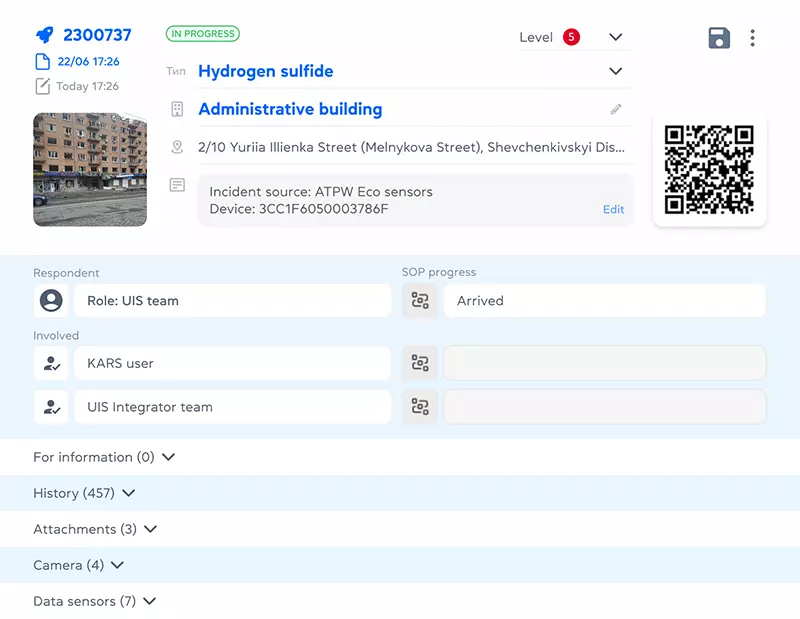
S.T.A.N. supports incident management throughout the entire lifecycle — from initial detection to full resolution — helping maintain control, process transparency and a rapid response. Each incident record includes detailed information on the location, cause and severity, enabling teams to assess the situation quickly and make informed operational decisions.
All relevant stakeholders have access to the information they need, while incident resolution progress is updated in real time. This supports a coordinated, consistent and efficient response across all teams involved.
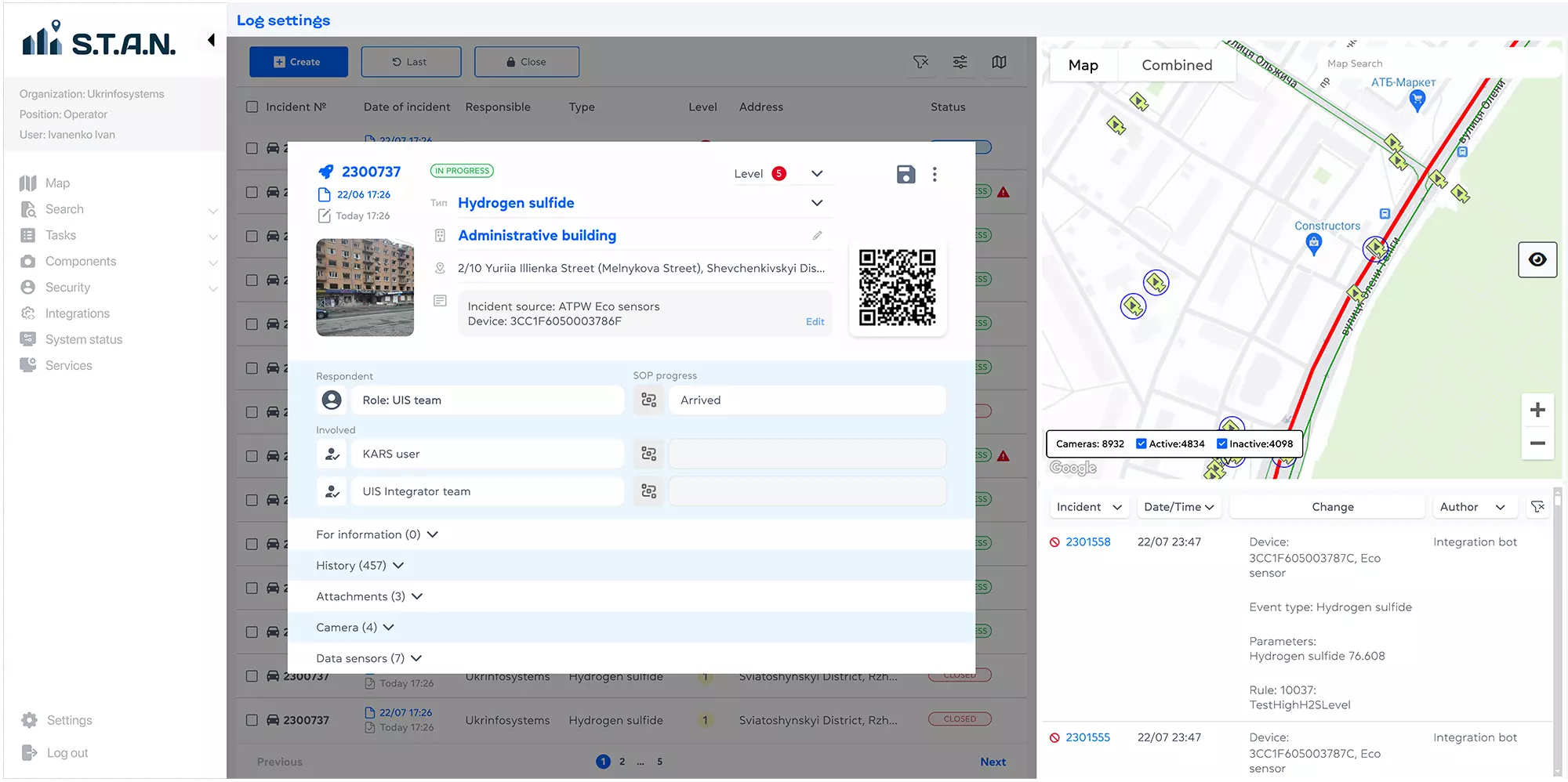
S.T.A.N. provides real-time event tracking linked to an interactive map. Users can view available cameras, check their current status, access archived footage and analyse the relationships between assets, cameras and incident locations within a single interface.
By integrating mapping services, route planning tools and video analytics, the platform enables teams to detect people and vehicles quickly, track their movements and coordinate actions across operational units. This improves incident response, strengthens situational awareness and enhances overall security.
HISTORY AND ANALYSIS
Intelligent analysis and forecasting
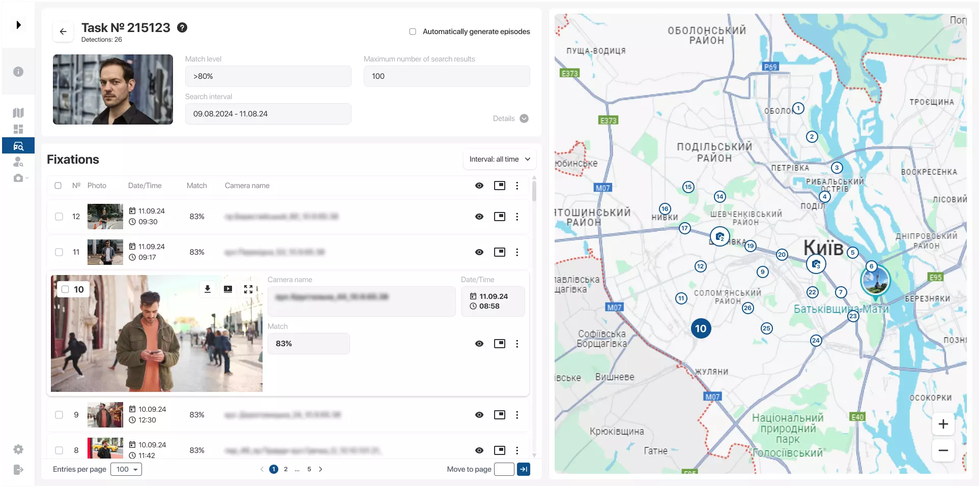
S.T.A.N. uses a powerful, scalable database to store video recordings and information on all recorded events. Its integrated search tools allow users to select any time period — from a single day to an extended date range — and review all events recorded during that period.
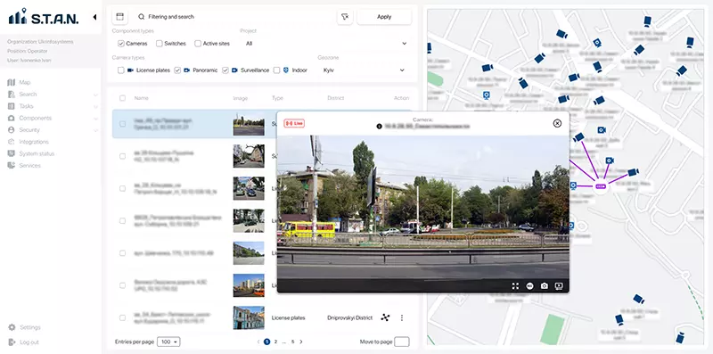
The system provides rapid access to archived data, event logs and video footage, helping users reconstruct the sequence of events and retrieve the information required for incident analysis and reporting.
This supports investigations, security planning and the ongoing development of urban and site infrastructure.
PLATFORM TOOLS
Core functionality and integration capabilities
S.T.A.N. brings together core operational and integration capabilities within a single platform for the centralised, real-time management of incidents, data and analytics.
Unified incident management interface
S.T.A.N. supports both manual and automated incident creation, providing end-to-end incident management and control within a unified incident management system.
Centralised access to maps and video
A unified interface for working with interactive maps, data lists, live camera feeds and archived video from multiple Video Management Systems (VMS).
Analytics data aggregation
Centralised collection and processing of data from analytics platforms and video analytics systems to create a comprehensive operational picture.
IoT, BMS and SCADA integration
Integration with pressure, environmental, hazardous substance and structural monitoring sensors, as well as other engineering systems.
Object search and tracking
Determine the location of people, vehicles and other critical assets within a city or across a site, and monitor their current position within the operational area.
Geolocation and movement history
Real-time tracking of moving assets, including route recording and trajectory analysis.
Route and patrol planning
Route planning for assets, response teams and patrols, taking into account events, areas of responsibility and the current situation.
Automated alerts and response
Automatic notification of relevant stakeholders when persons or objects of interest, suspicious events or potential threats are detected.
Analytics platform expansion
Integration of additional data sources to support advanced analytics and informed decision-making.
Multi-layered analytical reporting
Generation of comprehensive reports based on archived data, with the ability to analyse events across temporal and spatial dimensions.
AREAS OF RESPONSIBILITY
Territory and incident management
S.T.A.N. provides an intuitive, user-friendly interface for managing incidents and operational areas, enabling operators to assess situations quickly and make informed decisions.
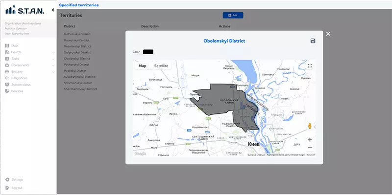
Users can filter incidents by date, priority level, event type, district or specific site, supporting rapid analysis of the current situation and effective prioritisation of response actions.
The platform displays incident locations on an interactive map and provides detailed access to key event information, including resolution status, assigned personnel and other critical data.
By managing incidents directly on the map, users can define zones across territories and infrastructure sites, view relevant sensors and cameras, and access system-generated recommendations. This allows the platform to be adapted to the specific operational requirements of a city or organisation and improves overall management efficiency.
TRANSPORT ANALYTICS
Traffic flow monitoring and route optimisation
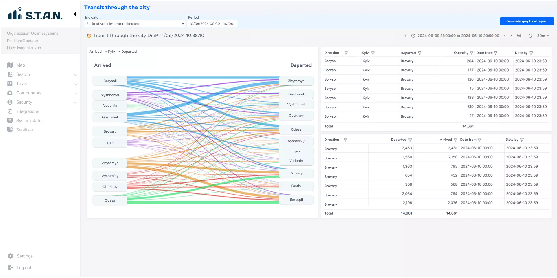
S.T.A.N. analyses transit movement across urban areas and displays:
- key routes
- entry and exit points
- traffic intensity
- route congestion levels
Interactive charts and tables allow users to filter data by time period and area, identify congestion and generate recommendations for optimising traffic flow.
This helps reduce congestion, improve road safety and support more efficient urban mobility management.
SECURITY AND GOVERNANCE
Risk forecasting and platform security
All user actions within S.T.A.N. are automatically recorded in the event log, ensuring system transparency and providing a complete audit trail.
S.T.A.N. supports multi-channel display of video and data on video walls used in control rooms.
APPLICATIONS
Who S.T.A.N. is designed for
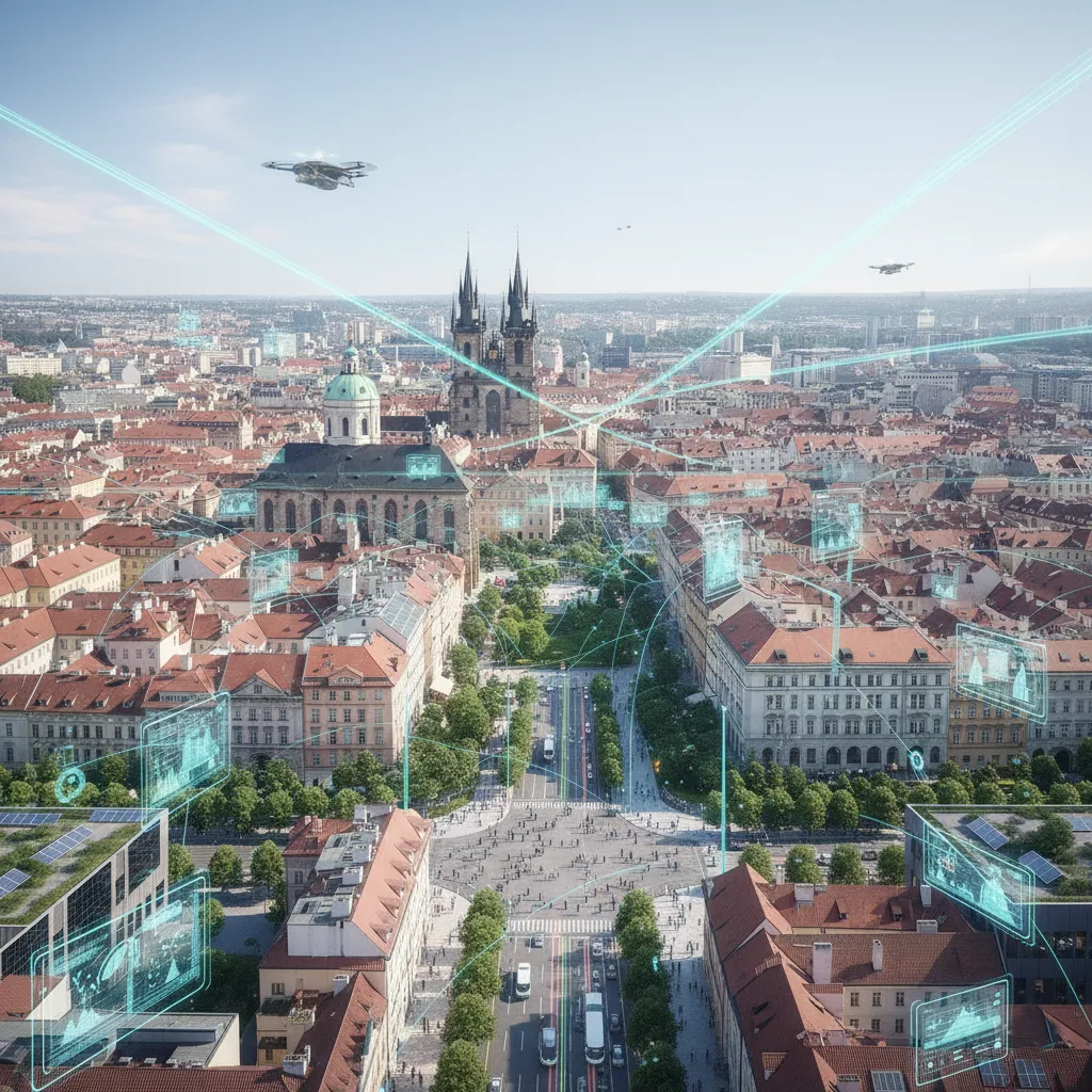
Smart City
S.T.A.N. is used to enhance urban security, monitor traffic flows, oversee environmental conditions and manage city infrastructure in real time.
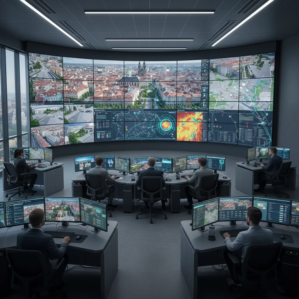
Control rooms
The platform provides centralised event monitoring and coordinated response for emergency services, municipal authorities and security operators through a single interface.
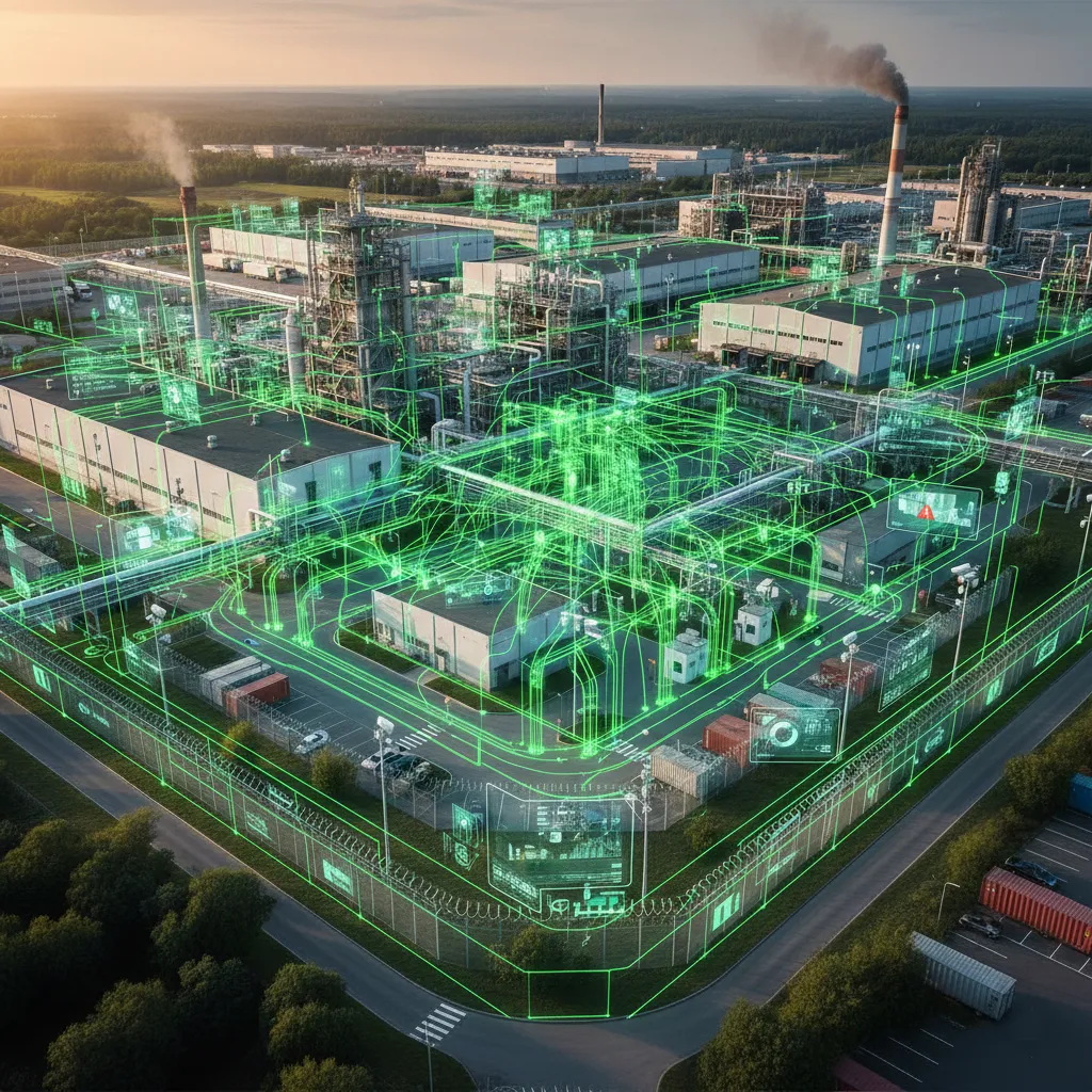
Large-scale facilities
S.T.A.N. is deployed across shopping centres, business parks, campuses and industrial sites to monitor incidents, enhance security and oversee the operational status of infrastructure.
CONTACTS
Learn more about S.T.A.N. or book a live demonstration
Tell us about your requirements, and our team will get back to you as soon as possible.
CIMP Soft™ is an officially registered trademark of Ukrainian Infosystems LLC.